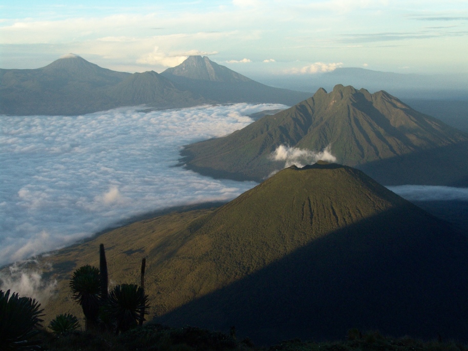
The
Virungas
viewed
from top
of
Muhabura
(Photo
by
Maryke
Gray,
IGCP)
Mgahinga
Gorilla
National
Park (MGNP),most famous for its exciting gorilla safari activities,
is
situated
amongst
the
Virunga
Mountains in
the
extreme
southwest
of
Uganda,
and
includes
sections
of three
of the Bufumbira
volcanoes;
Mt.
Muhavura
(4,127
m), Mt.
Gahinga
(3,474
m), and
Mt.
Sabinyo
(3,645
m).
The Park
is about
10 km
south of
Kisoro
and is
bordered
to the
south by
the
Republic
of
Rwanda
and to
the west
by the
Democratic
Republic
of
Congo.
Each of
these
countries
protects
its own
portion
of the
Virungas,
in the
Parc
National
des
Volcans
and Parc
National
des
Virunga
respectively.
The
three
parks
together
form the
434-sq.
km. 'Virunga
Conservation
Area' or
VCA.
Mgahinga
is 33.7
sq. km,
just 8%
of the
VCA. The
entire
Park is
in
Bufumbira
County
of
Kisoro
District.
From afar,
the huge
cones of
the Virunga
volcanoes
dominate
the
landscape
and
beckon
you as
you
approach.
When you
reach
the park
you can
get a
great
overview
of the
area by
walking
up the
viewpoint,
just 15
minutes
from
Ntebeko
Gate.
Mgahinga
Park has
great
biological
importance
because
throughout
the
climatic
changes
of the
Pleistocene
ice
ages,
mountains
such as
these
provided
a refuge
for
mountain
plants
and
animals,
which
moved up
or down
the
slopes
as
climate
became
warmer
or
cooler.
The
Virungas
are home
to a
large
variety
of
wildlife,
including
about
half the
world's
critically
endangered
mountain
gorillas.
The main
ethnic
groups
are
Bafumbira
and
Batwa.
The
Bafumbira
are
agriculturists
while
the
Batwa
were
previously
forest
dwellers
dependent
mainly
on
hunting
and
gathering.
The
Batwa
started
moving
out the
MGNP in
the
1930s
when the
forest
was
gazetted
as
forest
and game
reserves
and
occupation
and
hunting
were
formally
banned.
They
began
spending
more
time as
share-croppers
and
labourers
on their
neighbours'
farms
but
still
had
access
to many
forest
resources
and the
forest
continued
to be
economically
and
culturally
important
to them
before
the
areas
were
gazetted
as
parks.
Like
Bwindi,
the
human
population
density
of the
neighbouring
areas is
among
the
highest
in
Africa
with up
to 600
people
per
square
kilometer.
In an effort to conserve the worldlife in MGNP, the local communities have a share on the revenue
generated from park entrance fees such as gorilla trekking permits,
community walk fees, etc.
In 1996,
a
multiple
use zone
was
identified
stretching
500 m
from the
park
boundary,
within
which
communities
harvest
bamboo
rhizomes
for
planting
outside
the
park,
collect
water,
keep
beehives,
and
harvest
spear
grass
and
medicinal
plants.